
Guidance on following the route
The route is not marked on the ground in any way and participants must use the event map (aided by their GPS device if necessary) to follow the route when required.
Please note: the digital mapping link will be emailed out in the final information before the event
The organisers (and friends, family, members of the public and landowners) will be tracking participants’ GPS trackers in real time. We expect participants to stay within 200m of our advised route at all times.
In practical terms, for the majority of the time this is very easy as our route generally follows the only path or track on the ground: it is the only logical way. At other times, where there is no visible path on the ground, you will have flexibility to range within 200m of the route so that you should feel little pressure to follow our route precisely at all times and can enjoy the incredible wilderness experience to the full.

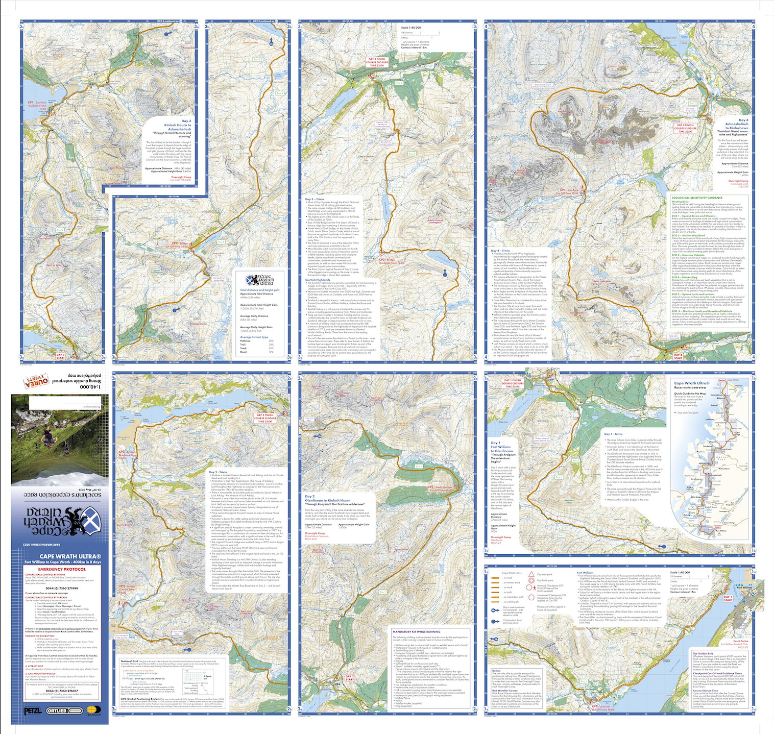
Day 2 start (and overnight camp on Day 1); beside the famous Glenfinnan railway viaduct - as featured in the Harry Potter films.
However, there are checkpoints, which participants will need to visit along the route. These are not tests of navigation but logical points that participants will pass through. Some checkpoints are manned and some checkpoints are unmanned, and this is clearly indicated on the map and documented in the article Guidance on checkpoints and cut-offs.
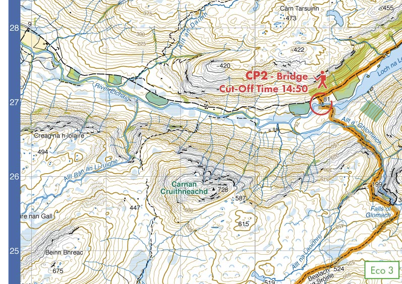
An example of a checkpoint on day 3 with cut-off time clearly visible.
We would only time-penalise or disqualify a participant for not following the route if we believe that they have gained an unfair advantage, and/or endangered themselves or others, and/or clearly passed through private property. Remember that the GPS track of each participant will be public and we will retrospectively review the route of all participants. In previous years penalties have been given.
Participants are reminded that they are ultimately responsible for judging the safety of the route. In exceptional circumstances (like rivers in spate) participants may need to deviate from the route, making their best judgement of the safest way, or to wait until the river has subsided. In these circumstances we would not penalise a participant.
The Event Map
Specially commissioned by Ourea Events
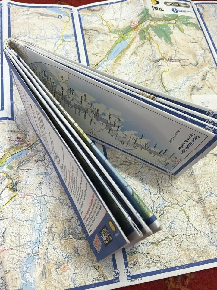
Participants will be provided with an event map at registration. The event map is an accurate, waterproof and annotated Harvey map of the entire race route that has been specially commissioned by us, and is updated each year to reflect any developments on the ground. It will also be a fantastic memento of the event. If the participant is confident and experienced enough with map and compass navigation, they will be able to complete the event - following the race route - using just the event map.
As below, the map will be presented with 15 map frames, all arranged onto two sides. i.e. A single-sheet double-sided map. It will be 1:40 000 scale (1km = 2.5cm), with contours at 15 metres vertical interval, over-printed with our route, our checkpoints, captions and various surrounding information and emergency info. The map has been paginated so that it has a thoughtfully ergonomic day-stage chronology.
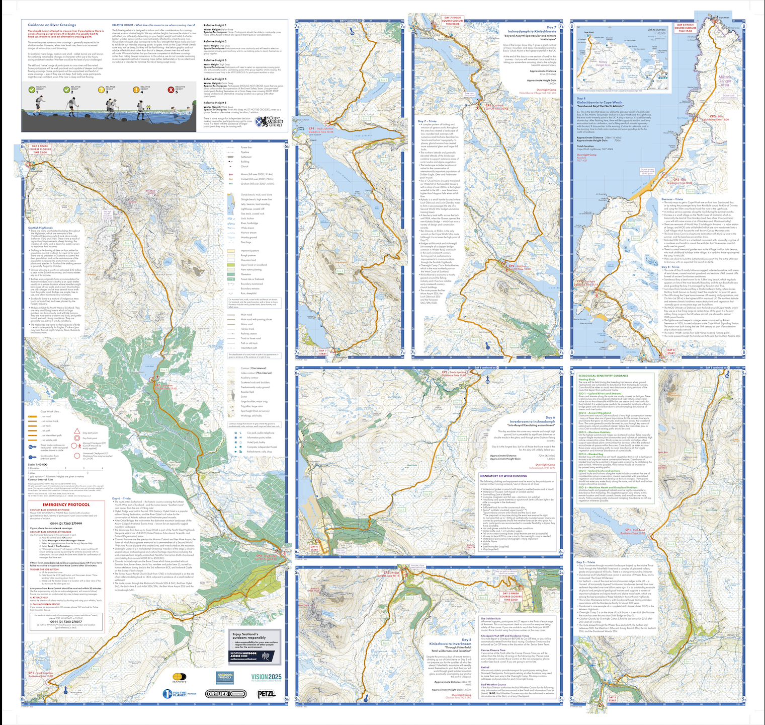
This is the 2022 map – you will get your 2024 map at registration
The nature of Harvey's latest waterproof paper technology gives a map that does not require bagging/protection, is easy to fold and not bulky, and is designed to survive the rigours of the roughest journey.
We have already used this map material very successfully in other events. We do ask that you look after this map as we only intend to issue one per participant. If a participants loses their map, they will be required to purchase a replacement as it is mandatory kit to be carried while running.
The digital version of the route
A digital version of the route will be available on the Avenza app. This will be shared in the final information before the event, giving people plenty of time to download it and get familiar with the app.
GPS devices
It will be possible for participants to follow the race route using just a GPS-capable device if you are experienced doing this. In this case, the paper maps could be stored in your pack (mandatory kit) as a back-up in case of power loss.
We will provide final versions of GPX files for each day’s route to participants ~2 weeks before the event.
A dated version of the route is available via the route pages year-round so that aspirant participants and others can access the route digitally at any time, but it is important to understand that this does get amended ahead of each event.
Information about checkpoints, and their associated cut-off times, and their associated guidance times, are included in the Avenza version of the route. Be aware: this waypoint info is also included in the available GPX files..
Prefer to use GPX files to import into your own device?
We provide access to GPX files (both individual day files and a combined all-days file) of both the previous year’s route (for recce trips and familiarisation) and a few weeks before the event, we will provide the final route for the upcoming event. These are only suitable for those participants who are more pioneering with their own GPS-capable device solution and understand the technicalities of how to use them. Sorry, we cannot offer one-to-one technical support.