Cape Wrath Trail/Ultra recce report
In September 2014 Shane Ohly (Cape Wrath Ultra™ - Event Director) and his wife, Heather, completed the Cape Wrath Trail. The following report is written by Shane Ohly.
Introduction
Before I start this adventure let me explain some important facts for potential Cape Wrath Ultra™ competitors.
First, I am writing this account of our journey in the hope that it will also be useful for other walkers considering the Cape Wrath Trail, and although many of the matters are transferable to the Ultra, they are not intended to be the definitive guide to the event or running the Trail - that's a more 'streamlined' set of advice that will come later. To reiterate this is NOT a description of the Cape Wrath Ultra race route!
Second, there is no official Cape Wrath Trail! Rather, there is a whole matrix of route choice options described in the Cicerone guidebook and shown on the excellent Harveys Maps. For example, we had always intended to avoid the more sedate Great Glen start and head out west to the wilds of Knoydart. There were two reasons for this: we thought this route would be more adventurous and remote, and this option would cover more of the proposed the Cape Wrath Ultra™ route that Gary Tompsett and I have been working on. Let’s make this crystal clear; the route I am describing here, whilst similar, is not the Cape Wrath Ultra™ race route.
Third, the time shown in the section header for each day is for the entire day’s walking and includes all stops. The distance information was measured accurately with mapping software after we had completed the walk.
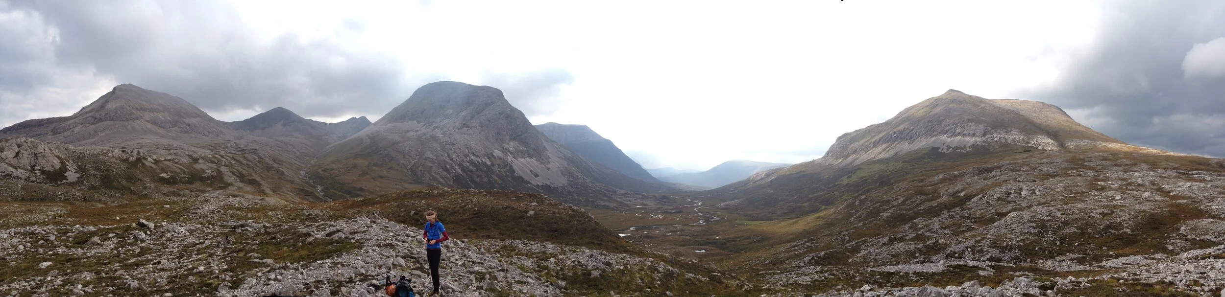
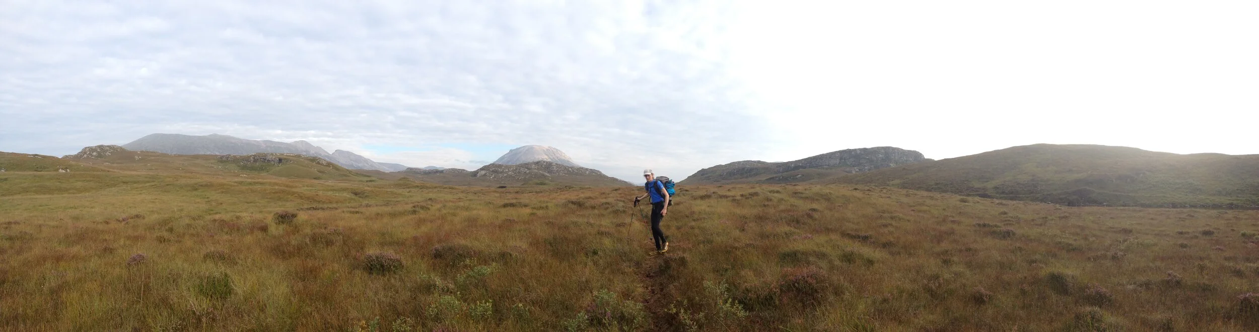
Day 1 - Fort William to Corryhully Bothy
Friday 29th August 2014 / 10h:30m / 37.8km / +1014m
We’d had to cancel our first planned attempt to walk the Cape Wrath Trail in June due to an injury of mine. It was now the end of August and it was great to finally get going. Weeks of carefully planning had brought us to this point with particular focus on our food resupply points where we would be picking up 4-days worth of food at each resupply. There would be little chance to supplement these rations because of the very remote nature of the route, so we wanted to have ‘just enough’ without overloading our rucksacks. Therefore some careful planning, packing and logistics were called for to ensure the right food was in the right place and the right time. Let’s get on with that adventure...
We had an early start in torrential rain to catch the 07:45 ferry across a brooding Loch Linnhe. Sheltering from the heavy rain in a nearby bus shelter the grey and overcast weather was clearly set for the day. Despite this, we were excited, and had arrived early for the ferry worried that it might be full and that our daily schedule would be blown at the first hurdle. We needn’t have worried though. There was just Heather, myself plus three teenagers on the boat as we set off from Fort William. Ten minutes later we arrived at Camasnagaul and a superb adventure began.
We made very quick progress along the loch side road to reach Inverscaddle Bay. Here we turned inland following a good track up Cona Glen and into the mountains. Crossing the Bealach to head down towards Glennfinnan it quickly became evident that the persistent heavy rain was going to cause problems for us as the path was by now a torrent of floodwater that was overflowing from the entire mountain. It was not possible to take a single step without being ankle deep in water. Soon enough we came to what would usually be a minor stream but was now in extreme spate and completely uncrossable. Heading further downhill was impossible as we were boxed in by another, even larger, roaring river at the bottom of the valley, so we had little choice but to head steeply uphill, thrashing through sodden thigh deep undergrowth, to seek a safer crossing point. It was a costly delay and an insight into the challenges that could be faced by the competitors and how these would impact on the event logistics.
We briefly considered camping under the famous ‘Harry Potter’ arches of the Glenfinnan viaduct to shelter from the rain but in the end decided to push on to the bothy at Corryhully. It was the right call. There was a very warm welcome into the bothy with a group of young ceilidh band musicians playing around a belting log fire. With the musicians and three other walkers, the bothy was busy so we opted to camp outside for the night.
Some early feedback from this video has been that, '"This river doesn't look uncrossable". It is important to note that even minor streams, such as this one (location HERE) will become uncrossable during heavy and prolonged rainfall. In this instance, the river was just too wide to jump across and the power of the water signifigantly too strong to wade through. There were also downstream hazards (waterfalls, rapids etc) that meant being swept away would almost certainly result in death.
Day 2 - Corryhully Bothy to Sourlies Bothy
Saturday 30th August 2014 / 9h:50m / 24.2km / +1098m
We woke to the sound of a second day of heavy rain but we managed to get walking by 08:55. We followed a track continuing northeast up the glen that was initially good but by the bealach had petered out and the going was rough and boggy. We passed two inexperienced Dutch walkers quickly. They had stayed in the bothy the night before and despite setting off over an over before us they had only managed 2km in nearly two hours (average speed just 1 km/h). They were moving very slowly in the rough terrain and were clearly wet and cold but we couldn’t offer them anything other than some encouraging words. Further down the glen heading towards Glen Pean we had a difficult and dangerous river crossing so that we would be on the correct side of the river to use the bridge further down the valley. We hoped our Dutch friends would be alright and felt a little uneasy at having encouraged them earlier; perhaps we should have suggested that they go back?
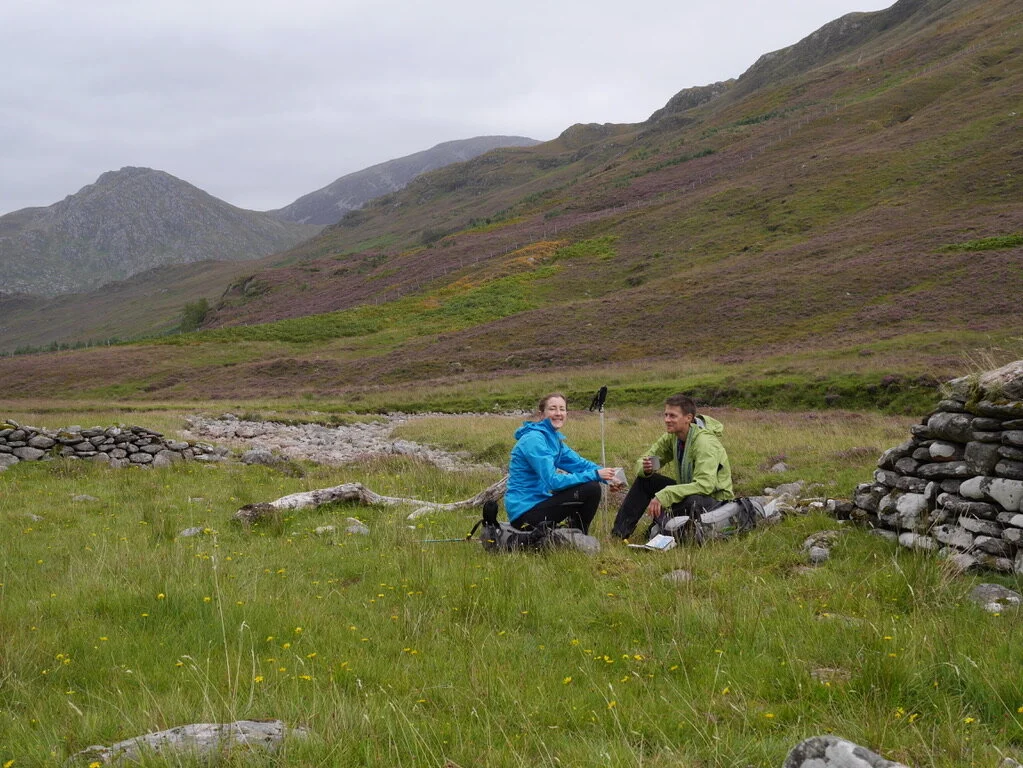
We stopped at the A ‘Chuil Bothy for lunch and to escape the rain. It was a welcome relief and well worth the short detour. All too soon lunch was over and, still hungry, we set off westward along Glen Dessarry and towards the sea. Feeing hungry after just a day and a half wasn’t a good sign and as we walked I worried that we had not brought sufficient food with us.
The continuous rain since yesterday morning meant that I still hadn’t taken my hood off since starting out, and we wondered what the record for continuous rainfall in Scotland was? We had said to each other whilst planning this trip that we needed to be prepared for 15 days of rain but the potential reality of that was beginning to sink in!
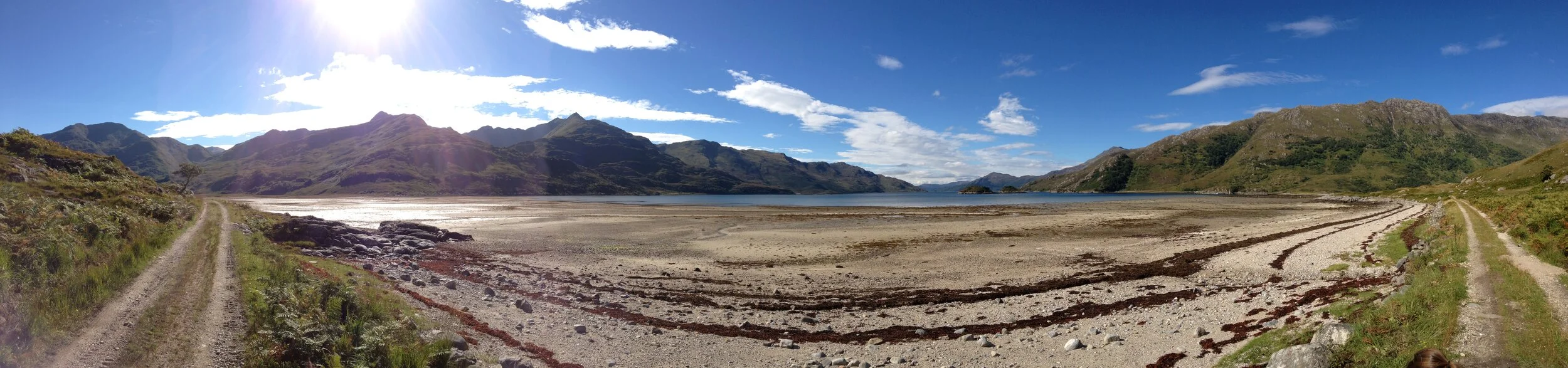
Tired from two long initial days, it was a great relief to catch our first glimpses of the stunning coast as the north Atlantic washes up against the western fringes of Scotland. The inlet where the Sourlies Bothy is located is truly beautiful and the rain finally stopped for our last hour of walking as the sun made its first appearance of the trip.
Day 3 - Sourlies Bothy to Kinloch Hourn
Sunday 31st August 2014 / 10h:00m / 26.3km / +1373m
Knoydart has a reputation and today we discovered that it is well earned! Following the River Carnach inland the terrain gradually becomes rougher, tougher and slower to negotiate. There were long sections with no discernable path on the ground and our average speed fell to just 2km/h.
Heather reminded me that I had thought our distance targets for each day looked easily achievable from the perspective of our front room just days before. Now, as we struggled through bog and tussock, I had to admit that she had been absolutely right to insist that we pay attention to the guidebook times and the impact of carrying a relatively heavy rusksack. Typically, I think as a runner both for personal adventures and the events I manage, so a real shift in my thinking had been required to create a realistic schedule for us.
At least the weather was good today, allowing for incredible views of the monstrous mountains of Knoydart and the stunning Loch Horn. Knoydart is one of the most remote and amazing places in the UK and, whilst the walking was challenging most of the time, every step was worth it.
We pushed on from Barrisdale later than planned, arriving at Kinloch Hourn just as the light was fading and the rain sweeping in again. Passing the small B&B and café, which we had assumed would be closed by this time, I couldn’t help but noticed a sign saying “we are always open. Come on in”. We knocked hopefully and, sure enough, received a tremendously warm welcome and within minutes had mugs of hot chocolate with eggs, beans and toasts on the way.
Despite the extra meal, I had a sense of humour failure that evening as we battled to get the tent up quickly in the heavy rain and a cloud of midges. For the last few days I’d been getting a painful rash that had spread from my ankles upwards and had now reached my thighs. At first I couldn’t fathom what on earth was causing it but eventually deduced that it must be heat rash from the combination of GoreTex socks and wool trekking socks that I was wearing (this was despite not having the sensation of hot feet and despite using this same combination for long walks previously without incident). My problem now was that I didn’t have any thinner socks with me and my only choice was continue with bare feet in the GoreTex socks, but I was concerned this would increase the chance of blisters and/or sweaty foot rot. I had no choice though, as the rash was too sore to continue as I was.
Day 4 - Kinloch Hourn to Shiel Bridge (Resupply 1)
Monday 1st September 2014 / 6h:50m / 17.5km / +964m
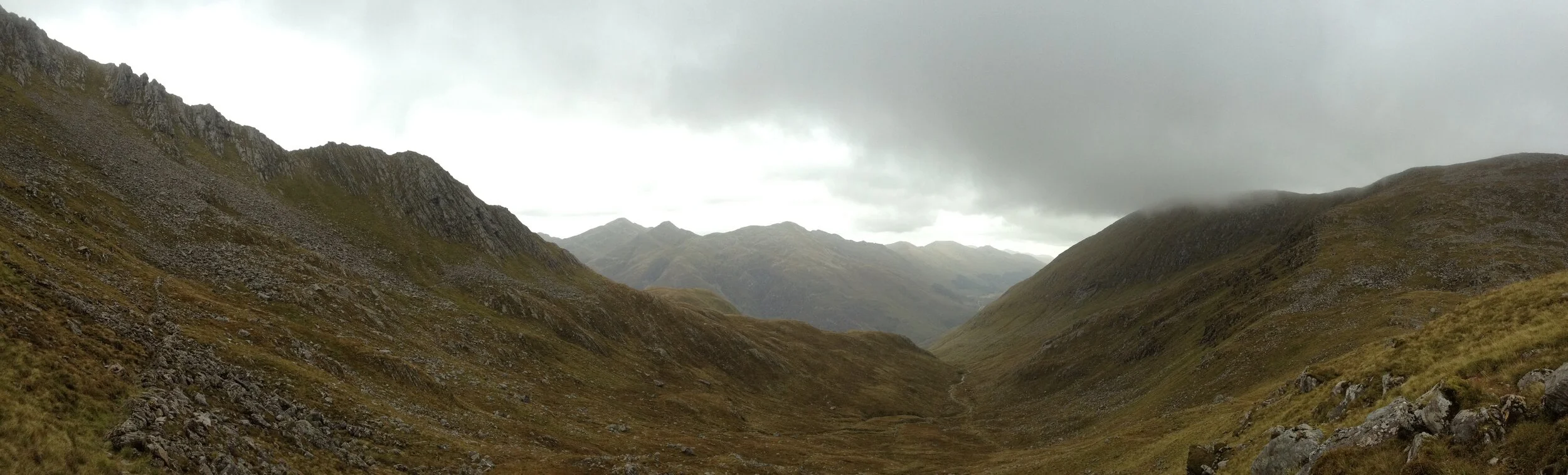
I’ll be honest and say that our spirits (mine in particular) were low last night. The rash, the midges, the rain and a forecast picked up from another walker for very poor weather today meant it all felt like a bit of a struggle… it was meant to be a holiday after all. However, we woke to high cloud that didn’t look like rain and that alone felt like a good omen as we knuckled down to another day on the trail. We made good time to reach the high Bealach Coire Mhalagain between the two enormous Munros of The Saddle and Sgurr na Sgine. It was our first high pass at close to 800m and the views were spectacular; Scotland at its very best.
Enjoying the journey much more with the improving weather, we stopped in a sheltered spot a little further to the north and reminded ourselves that we should take every day as it comes. It is amazing how much a shift in attitude changes everything and our fourth day was a total pleasure. The heat rash on my legs had improved and removing the wool trekking socks had clearly made a small but important difference to the microclimate inside my trousers!
We had planned to have a shorter fourth day after three long ones, so that we could maximise our time at Kintail Lodge, where we were staying in Shiel Bridge and collecting our first box of food. The incentive of a hot shower, my first coffee for four days and a beer had a magnetic pull. Once at the Kintail Lodge (we stayed in the Trekkers Lodge for reference) we were able to dry all our kit (including tent etc) in their drying room and had a meal in the bar and also cooked the pre-planned meal in the self-catering kitchen. With all that and a comfortable bed for the night, it was the perfect pit stop for us.
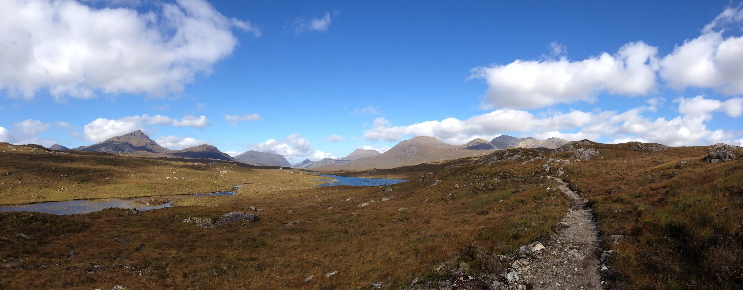
Day 5 - Shiel Bridge to Maol Bhuidhe Bothy
Tuesday 2nd September 2014 / 8h:20m / 25.7km / +1157m 15:53
Trekking north and little to the east, it felt as though we were heading further and further into the wilderness today. The weather was good and we had settled in a good sustainable walking pace and routine now. We would start in the morning and walk for two hours, break, walk for another hour, break, walk until lunchtime and have a longer break (often around 30+ minutes) and then split whatever was remaining for the afternoon into two sections with a break in between. This doesn’t include photo and video stops, which were numerous! Overall, and again from a runner’s perspective, it all felt like a very relaxed pace and made for an enjoyable experience in which it was possible to soak up the stirring landscapes. Sure, one could go faster and certainly we could have gone faster if we had turned each day into a ‘mission’ but this approach felt like the right compromise; holiday speed!
The conditions underfoot were much better and we followed good tracks all day, which would be superb for running on. We played tag with two other walkers, another Dutch couple, a father and son team this time, all day as we both headed towards the Maol Bhuide Bothy. The last few hours of the day felt particularly remote as we headed north towards Beinn Dronaig with sweeping and undulating peat hags all around and towering mountains in the distance. Catching the first glimpse of Maol Bhuide Bothy was exciting. The building is painted white and stood out very clearly from the autumnal mountain green and browns around it.
At the bothy we exchanged and compared stories of the Cape Wrath Trail with the Dutch team. As with most of the other walkers we met on route, they were completing a short section of the overall trail and had flown in for just a few days of mountain walking that could be linked with public transport at each end. We quickly got into a discussion about kit, which was initially prompted by their disbelief that we were wearing fell running shoes! This was the same series of questions and answers that we went through with almost every other walker we met. They would be wearing, stiff, heavy duty, leather boots and they all had wet feet… whereas we were wearing lightweight fell running shoes with GoreTex socks and had dry feet… make your own mind up!!! Our mountain marathon experience and lightweight equipment also meant that we had fitted everything into 40L rucksacks with a tent and waterproofs carried externally, whilst the Dutch team had very large expedition sacks. There is a video about clothing and equipment HERE.
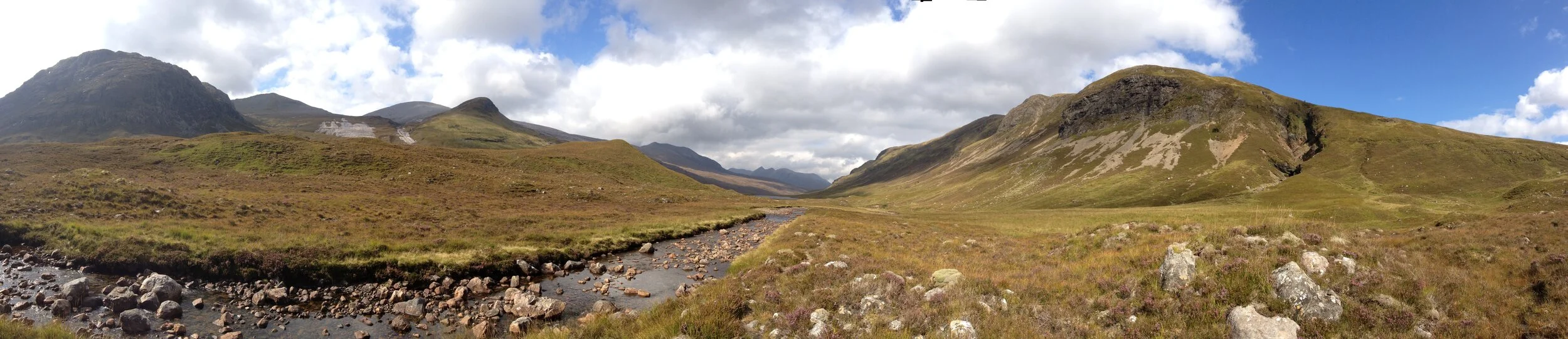
Day 6 - Maol Bhuidhe Bothy to Coire Fionnaraich Bothy
Wednesday 3rd September 2014 / 8h:20m / 23.6km / +740m
After a superb night in a superb bothy, we had an early start with a long tedious traverse along the boggy, tussocky and pathless terrain on the southern flanks of Beinn Dronaig. The first 5 or 6 kilometres were hard going and the contrast between the trackless sections of the route and much faster sections on paths is definitely one of the features of the Cape Wrath Trail. I think that as a runner, with a lightweight pack, these trackless sections would be much less arduous but with a heavy pack the going was slow and we were very thankful for having walking poles, which helped considerably in the rough terrain.
Despite having our own lunch with us, we stopped for a second lunch at the Strathcarron pub. This tactic also became a feature of the trek in that we would supplement the food we carried with the occasional pub or hotel meal en-route. We found that all we talked about in the miles before a potential extra food stop was how much we would eat! With hindsight we realise that we were carrying slightly too little food if we hadn’t been able to supplement it with these extra meals but as it transpired, we got it almost perfect in the end. I’d certainly recommend planning to have these extra meal stops, but there aren’t very many places to choose from.
Despite the long extra lunch break, we arrived at Coire Fionnaraich Bothy with sufficient time to strip off and have a good wash in the nearby stream. It wouldn’t be fair to continue without mentioning another major consideration of the journey at this stage: ticks! When we had set off we had both tucked our trousers into our socks each day (this clearly contributed to my heat rash problems with less circulating air) but I was still ending up with many ticks embedded in me by the end of each day. They’d be found anywhere from my waist to my ankles and today I found one attached to the end of my.….! Not nice. Despite taking the same ‘tuck-trousers-in’ approach, Heather had far fewer ticks (often none) so there was obviously something they liked about me. It was the same with midges and the same with mosquitoes when abroad. Eventually I found that the most effective anti-tick procedure was to cake myself in insect repellent from my toes up to my belly button each morning before getting dressed. Once I’d started doing this the tick count dropped to between 0-2 per day. Certainly, I recommend anyone walking the Cape Wrath Trail to take a tick removal tool.
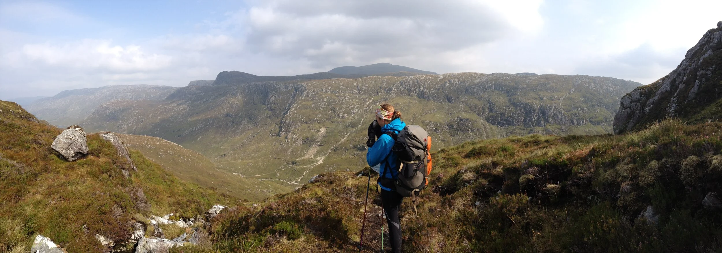
Day 7 - Coire Fionnaraich Bothy to Kinlochewe (Resupply 2)
Thursday 4th September 2014 / 10h:45m / 29.9km / +1299m
We knew today would be a long one and set a 0600 alarm and were walking by 0730. Heading north towards Torridon on some great paths we were rewarded with magnificent views of Liathach and Beinn Eighe. What superb mountains!
Although a little circuitous, we had decided to walk around the back of Beinn Eighe so that we could get the view of the monstrous Triple Buttress and experience the more remote and challenging route into Kinlochewe. We had made really quick time all morning and into the afternoon on excellent mountain paths until arriving at the waterfall on the northern edge of Loch Coire Mhic Fhearchair (this is where you get the stunning views south to Triple Buttress and north into endless wilderness). Here though, the path peters out and our average speed fell back to around 2km/h as we picked our way through very challenging terrain consisting of occasional bog, many tussocks, boulder strewn slopes and lots of heathery undergrowth. The terrain is tedious and torturous and remains like this for nearly six kilometres. With each step we could feel our morale being depleted and our patience with each other reducing. A sense of humour failure looked imminent!
We wondered whether our route choice had been a good idea or not but with the benefit of a few months perspective since the walk, the superb and remote mountain experience has stayed with us long after the memory of the difficult walking has faded.
Arriving in Kinlochewe later than we had planned we were delighted to find that the excellent Whistle Stop Café remained open until 2100 and enjoyed one of those bonus meals! We continued on to the Cromasaig B&B where we had another warm welcome from Tom Forrest and his wife Liz. Tom is a very experienced walker/runner and in his day set records for racing from coast to coast in Scotland. We’d highly recommend staying here and enjoyed an evening talking with Tom about how the Cape Wrath Ultra route could differ from the Cape Wrath Trail route, to make the most of remote Scottish wilderness, for runners who should be moving quicker than walkers… you’ll have to wait until the event in 2016 to see what we cooked up!
Day 8 - Kinlochewe to Shenevall Bothy
Friday 5th September 2014 / 9h:00m / 27.9km / +752m
Before leaving the B&B, we weighed our bags for the first time on Tom’s luggage scales. This was with a full four-day load of food so it was heaviest our bags ever got. Mine was 13.5kg and Heather’s was 12.7kg, the difference mainly being some slightly heavier food items that I was carrying. We adopted a system that we’d eat Heather’s meals first, so that her bag lightened more quickly than mine and we both found it surprising what just few kg difference made to our overall enjoyment each day. I can’t recommend enough to carefully plan your food and invest in lightweight clothing and equipment.
Today was one of the best of the trek. We had a late start from Cromisaig B&B after a truly gigantic breakfast and (for me) gallons of coffee. We headed initially east from Kinlochewe before swinging north and up Gleann na Muice towards Lochan Fada. As we walked the weather steadily improved until we had a stunning autumnal day with clear blue skies, warm sunshine and cool breeze. It was perfect trekking weather and by late morning we stumbled upon one of the great discoveries of the entire trip… the Infinity Plunge Pool! We were crossing a large stream and happened upon a rounded pool, carved smooth by the action of the water. The pool sat just on the lip of a waterfall and the flow of water was just perfect so that the icy stream flowed through the plunge pool and over the waterfall without risk of being swept away. Little encouragement was required and we both stripped off and enjoyed a bracing whirl before standing like cormorants to dry in the lunchtime sun. Perfection.
That afternoon we continued on mostly good paths to reach Shenevall Bothy. This is another one of those hidden highland gems and it being Friday night, we expected others to be there. We were alone with the rats and mice though and what a pleasure it was.
Day 9 - Shenevall to Knockdamph Bothy
Saturday 6th September 2014 / 13h:20m:00 / 37.8km / +1641m
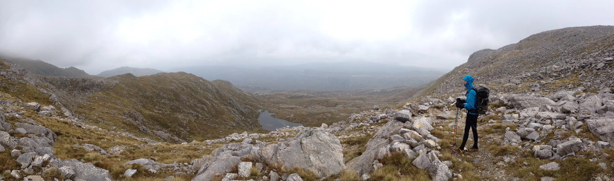
During the night we had heard the rain arriving as it thundered down like a hail of bullets on the roof of the bothy. We knew that with such a good day yesterday there would be a price to pay and sure enough there was torrential rain overnight and early morning. As such, the entire mountainside was in spate (see video) and rivers, streams and tiny trickles had all blown up into dangerous raging torrents, many of which would have been uncrossable.
Fortunately, we didn’t have any major river crossings this morning and knuckled down to a hard and wet drudge northeast via good 4x4 tracks to reach the A832 after approximately 7km. As we drudged I started to question why on earth I was doing this… after all, I don’t usually even like walking! However, the rain slowly eased and my mood lightened and I just needed to look around at the incredible Scottish highlands to remind myself that this was indeed a very special experience.
As we walked we started to reformulate our schedule. The day had originally been planned to be short, but we realised that if we added an additional 17km we could reach Knockdamph Bothy and the impact of this would be two half days later on in the trek. This seemed like a good idea and we were both in the mood for a bit of a mission. With the new plan and a renewed sense of purpose, I felt much happier with a long challenging day ahead.
By early evening we had reach the renowned Glen Douchary. It was stunning and everything promised by the guide, but with all the overnight and morning rain the River Douchary was in spate and clearly going to be a massive and dangerous obstacle. It was dusk and with the real threat of more rain overnight, it seemed foolish to camp now in the hope that the water level would fall overnight. Turning back meant a huge detour and with the failing light some decisive action was required. I crossed the first section of river alone, dropping my bag on an island about 1/3 of the way across, returning to help Heather. Some sharp words were required to get her into the river but, locking our inside arms together and using one walking pole each in our outside hands, we made it to the island.
The next 2/3 of the river was more serious, the water was flowing very quickly and to fall would certainly mean being swept away. We adopted the same stance and moving one leg at a time crept slowly across as the water pressed and pulled hard against our legs and lapped up to hip level of my upstream leg. This was what I call a ‘high consequence’ position and about the limit of what we could justify. It was a great relief as the level of water started to recede as we approached the far bank and safety, Heather warning me “keep it steady until we get there”!
Darkness enveloped us as we reached Loch an Daimh, but we easily followed the good 4x4 track to reach Knockdamph Bothy at the eastern end of the Loch. It had been a long ‘mission’ day for sure!
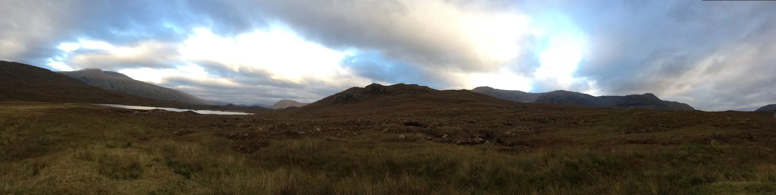
Day 10 - Knockdamph to Glen Oykel
Sunday 7th September 2014 / 7h:45m / 27.2km / +613m
We had a later start today after the extra long day yesterday and didn’t get walking until well after 0900. Our route continued eastwards following Glen Einig on excellent 4x4 tracks so progress was quick. We arrived at Oykel Bridge and stopped for a bonus extra lunch at the Oykel Bridge Hotel and a warm welcome from Dan, the hotel manager.
We timed our arrival perfectly. Sunday is the change over day in the hotel and the normal ‘hunting, shooting, fishing’ residents were nowhere to be seen. Fishing is banned on Sundays to give the salmon some respite and allow adequate numbers to reach their breeding ground. We had the hotel to ourselves and enjoyed a three course lunch and a long break (I even took the opportunity to dry some damp kit on a hotel radiator). Soon enough though, the next intake of residents started to arrive and the very first one was a total character of the comical ‘hunting, shooting, fishing’ brigade and it was definitely time for us to head off.
We continued along the River Oykel, which was deserted because of the Sunday fishing ban. The landowner here has erected some signs to direct Cape Wrath Trail walkers away from the riverbank and into a nearby forest. We ignored these signs, as I would recommend other walkers to do, and followed a good riverside path until we found a superb camping spot by the river about a kilometre before Loch Ailsh.
Today was a transition day as we travelled through low-level valleys to make the move from the mountains of Torridon towards the mountains of Assynt further north.
Day 11 - Glen Oykel to Inchnadamph (Re-Supply 3)
Monday 8th September 2014 / 5h:45m / 17.6km / +594m
This was the first of bonus shorter days created after the extra long day to reach Knockdamph Bothy (Day 9). It was also my birthday and we wanted to arrive at the Inchnadamph Hotel with sufficient time to relax, dry kit and have a decent celebration… I also needed to bury myself in answering emails for a few hours.
The journey to Inchnadamph involved a gradual climb up to pass through an obvious v-notch just southwest from Conival. Most of the day was on good tracks again with a few shorter sections of rough, trackless ground.
Day 12 - Inchnadamph to Glendhu Bothy
Tuesday 9th September 2014 / 8h:20m / 20.4km / +1065m
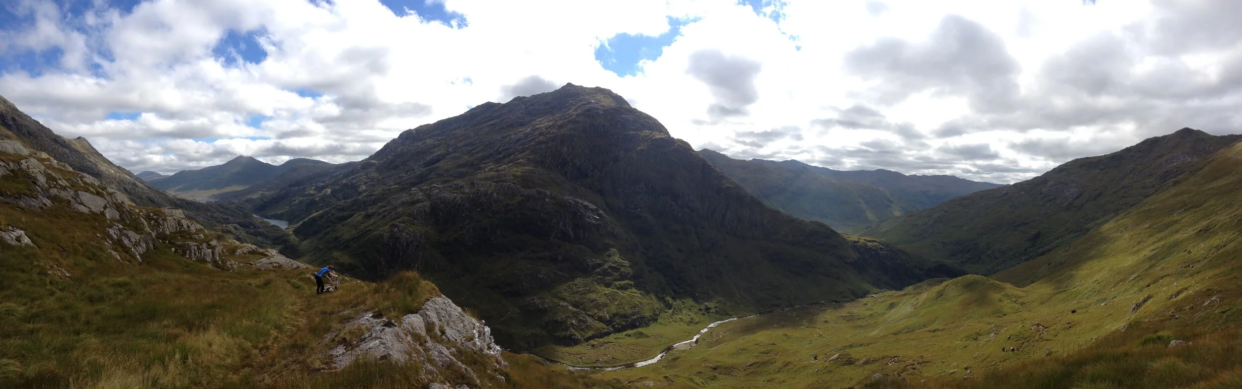
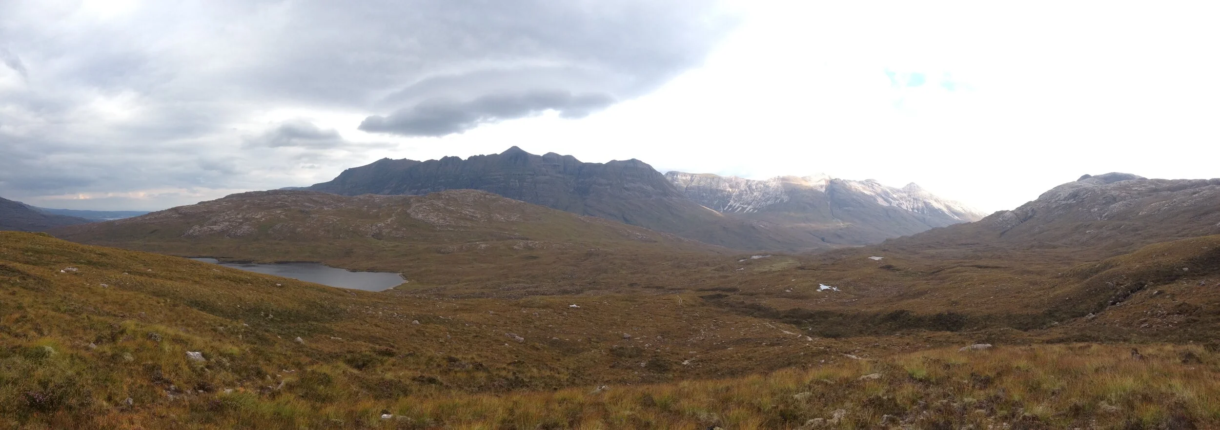
Brilliant, just brilliant. This was how I recalled this day and we felt it had been one of the best of the trek. The first half is on good mountain footpaths winding through an incredible landscape of breathtaking rock architecture (unusual limestone geology), aqua marine sea lochs, towering cliffs and cascading waterfalls. Progress should have been quick but we stopped to take so many photos!
As we dropped into the valley leading to Loch Glencoul the path slowly disappears as we were back to rough walking. To our east, we admired Eas a' Chual Aluinn cascading down the mountainside. This waterfall is reputably the UK’s highest with a drop of around 200m.
We stopped for lunch at Glencoul before making the slower than expected journey over the Aird da Loch headland, which involved a steep climb to 200m from sea level and some more rough terrain. It is certainly a feature of the Cape Wrath Trail that you get many sections of good tracks followed by shorter sections with no discernable path at all.
Arriving at Glendhu Bothy in the next cove by early evening, we settled in for another superb night in a deserted bothy.
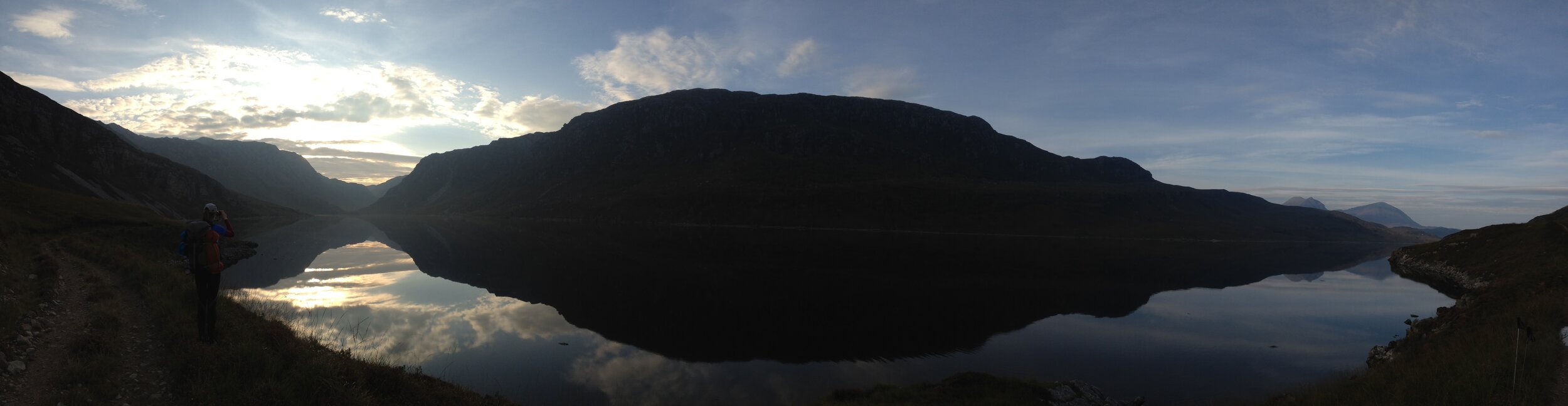
Day 13 - Glendhu Bothy to Rhiconich
Wednesday 10th September 2014 / 10h:30m / 29.2km / +1169m
Another long day over some rough terrain. I was shattered by the time I wrote up my route notes that evening in the Rhiconich Hotel where we called in for a beer and a bonus meal.
When I had woken from a deep sleep that morning by our 0600 alarm, I had felt more stiff and sore than any day so far on the trek. The joint of my big toe on both feet was giving me some pain and my right ankle was sore. My shoulders had started to ache from the continuous weight of my rucksack and I need some TLC… it came in the form of Voltrol Gel!
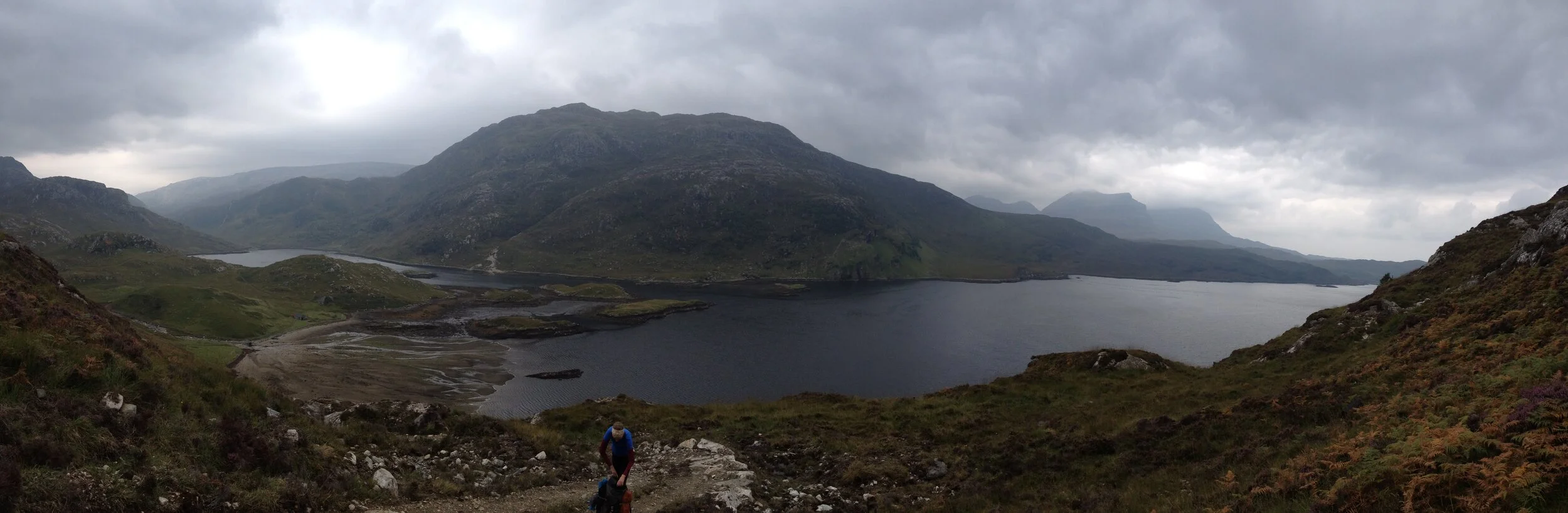
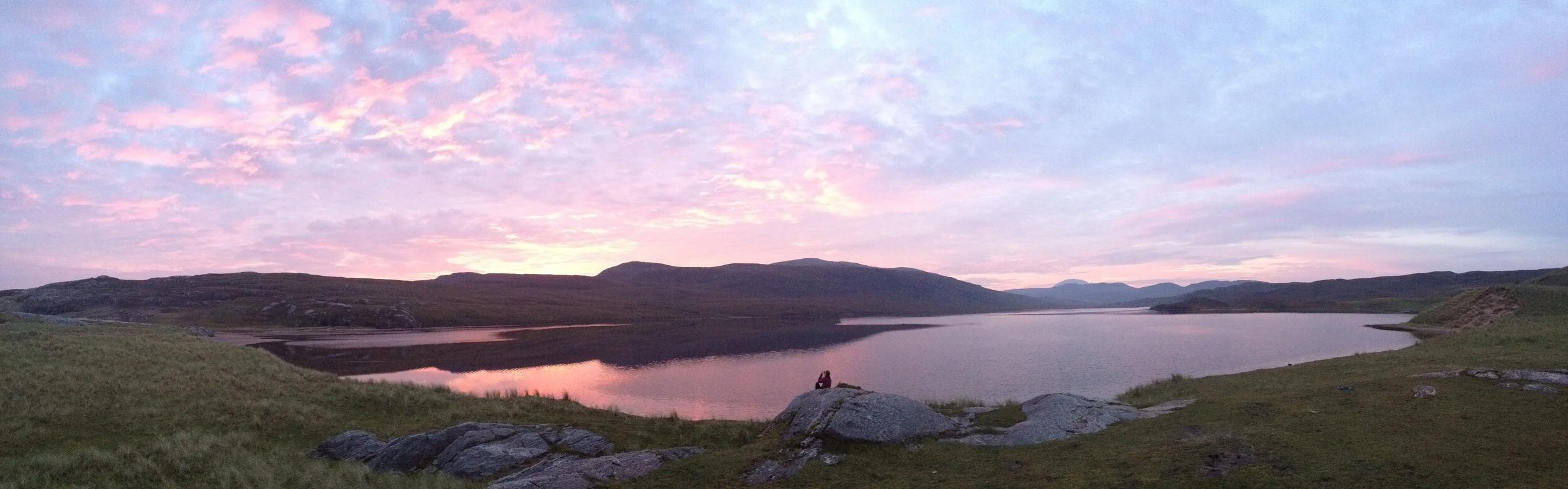
However, I couldn’t help but be inspired the moment we started walking. It was the finest morning of the trek so far; perfectly still, warm sunshine and superb views. Loch Glendhu was mirror smooth and the surrounding mountains reflected perfectly off the water.
Our early start was rewarded with four sea otter sightings in two hours, as we followed the Loch side track west. We then turned north and inland and gradually ascended to the summit of Ben Dreavie, which incredibly was the only mountain that our route summited in 15 days. Once again the views were spectacular with the impressive Ben Stack to the North.
From Ben Dreavie we dropped into the valley and passed Lockstack Lodge before turning northeast and following an intermittent path along the two large Lochs that feed the River Rhiconich, which eventually lead to Rhiconich itself. By now it was late and with nowhere else obvious to camp to opted to stay on some rough ground close to the Rhiconich Hotel. It was certainly the worst campsite of the trek and the arrival of clouds of midges meant that we quickly retired to the hotel bar and listened with fascination to the locals discussing the benefits or not of independence from the rest of the UK. It was a colourful and lively debate, and we had to choose our words carefully when asked to comment!
Day 14 - Rhiconich to Sandwood Bay
Thursday 11th September 2014 / 5h:30m / 19.6km / +542m
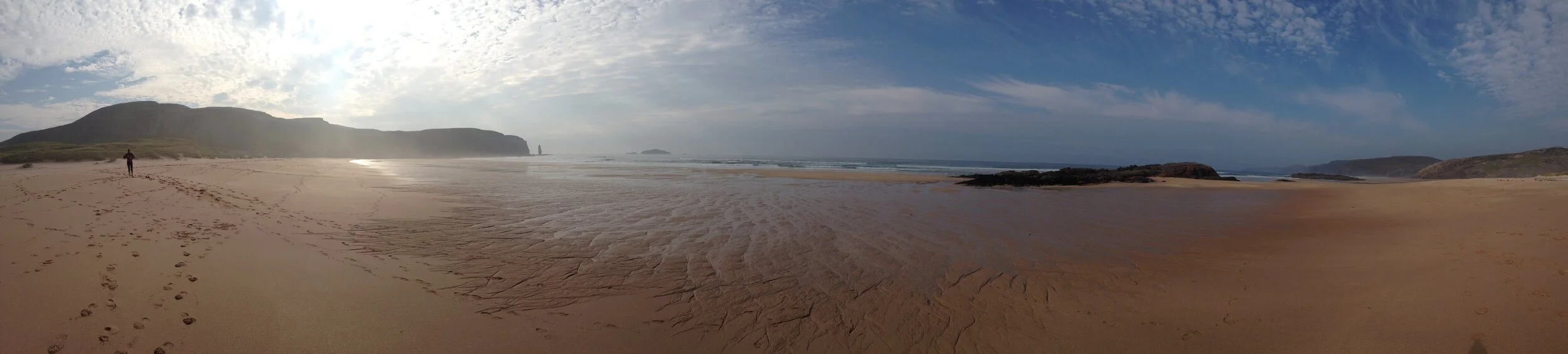
Today was our penultimate day of trekking and another short day courtesy of the super long day 9. We followed the road next to Loch Inchard to pass through Kinlochbervie and further on until turning onto an excellent track leading to Sandwood Bay.
We had heard so much about Sandwood Bay. Every superlative word imaginable must have been used to describe the remote and wild beauty of this beach and honestly we prepared ourselves to be disappointed. Surely nothing could live up to such a billing?
We weren’t disappointed! Sandwood Bay is quite remarkable and, after finding a discrete camping spot in the sand dunes between the beach and Sandwood Loch, we enjoyed an entire afternoon and evening on the beach. It was a memorable and relaxing place to spend the last night of our journey up through the West Highlands of Scotland.
Day 15 - Sandwood Bay to Cape Wrath
Friday 12th September 2014 / 4h:30m / 12.8km / +547m
As we left Sandwood Bay, we reflected on our journey and how different life on the trail is to ordinary life. There is such a simple pleasure in just eating breakfast, walking all day, eating dinner and (mostly) enjoying a night of remote camping or bothy living.
Slowly the beach faded into the distance as we started the last 12km of the trek. As with much to the Cape Wrath Trail, it is easy to underestimate the rough and undulating moorland that leads to Cape Wrath, which makes for slow progress. In bad weather this section could be really tough. Before too long we caught the first glimpse of the Cape Wrath lighthouse and it hit home that our journey was soon to end.
The guidebook explains that the experience of the Cape Wrath Trail will stay with you long after the walking has finished and we could already sense that undertaking this trek was an extremely satisfying personal experience that would indeed leave a long and permanent marker with us.
The end!